Landslides in the western U.S. are very much in the news lately, so I thought I’d put together a brief listing of some data, images and video on a few of them. Most of the listings below are related to the Oso, Washington landslide. But because of unusually wet conditions that have occurred during the past several months throughout parts of the western U.S., I’m also including information on yesterday’s landslide in northwestern Montana and on the Colorado Front Range storm event of September 2013.
The Oso, Washington Landslide:
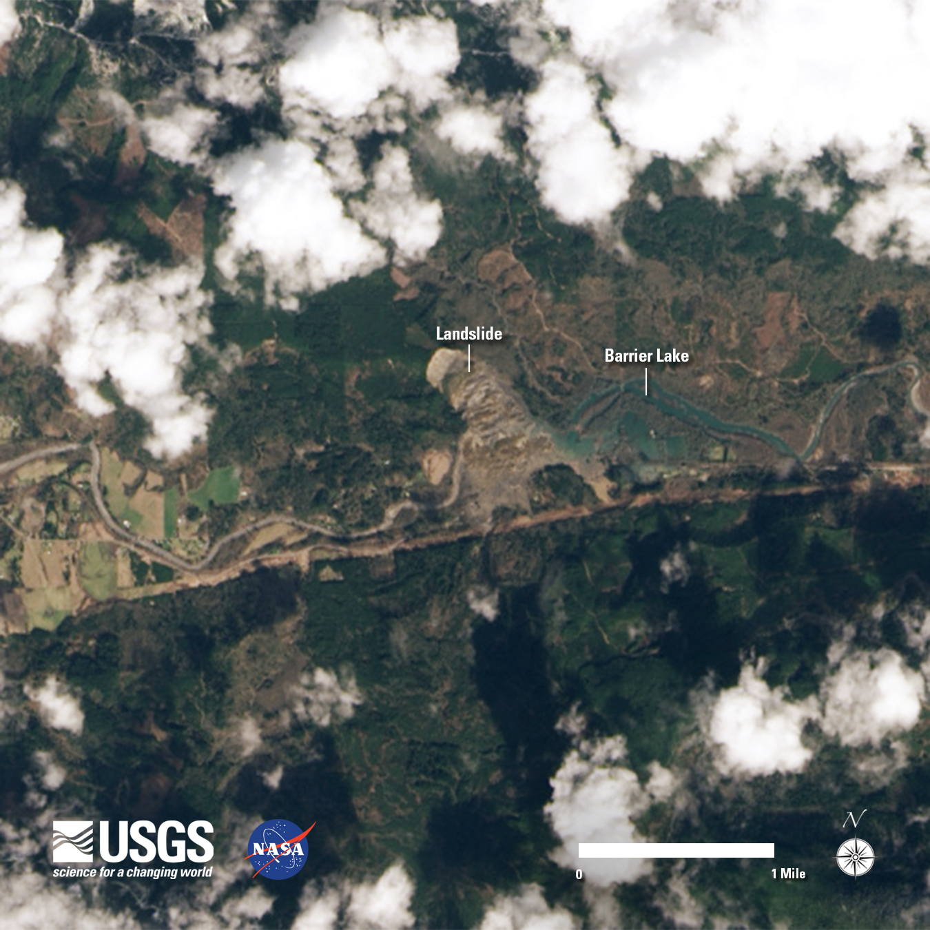
The landslide near Oso, Washington happened on Saturday, March 22, 2014, when an unstable hillside collapsed and propelled mud and debris across the North Fork of the Stillaguamish River. The 1-square-mile (2.6-km2) slide obliterated property and also created an earthen dam and a barrier lake. The slide is known as the “Hazel Landslide” and has reportedly been an active area of earth movement since at least 1937.
In a Washington Post video, David Montgomery, a geology professor at the University of Washington, briefly outlines the cause of the Oso landslide:
[embedplusvideo height=”315″ width=”584″ editlink=”http://bit.ly/1e7KHPW” standard=”http://www.youtube.com/v/5yy1Ygvend0?fs=1″ vars=”ytid=5yy1Ygvend0&width=584&height=315&start=&stop=&rs=w&hd=0&autoplay=0&react=1&chapters=¬es=” id=”ep3776″ /]
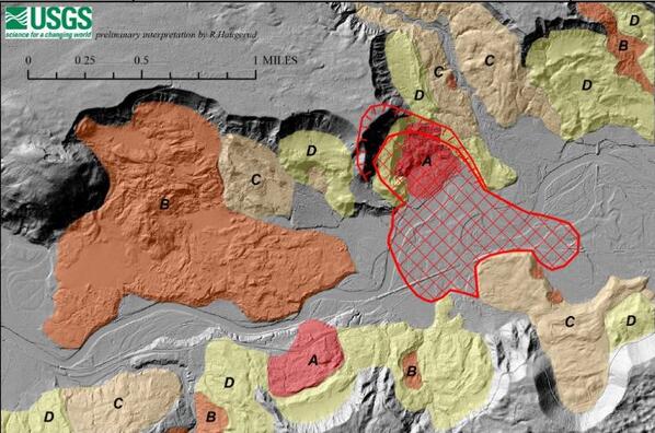
Past landslides in the Oso area are delineated in a new US Geological Survey report based on a 2013 high-resolution lidar survey of the North Fork Stillaguamish River Valley which was acquired by the Tulalip Tribes in partnership with the Puget Sound Lidar Consortium:
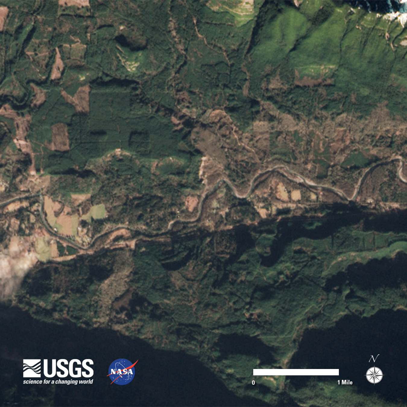
The U.S. Geological Survey has also posted before and after Landsat 8 images of the Oso slide area. The March 23, 2014 image clearly shows the slide deposits:
Snohomish County, Washington, released video of a March 23, Sunday afternoon flight over the mudslide area. The video was taken with Washington State Patrol equipment aboard a Washington State Patrol aircraft:
[embedplusvideo height=”315″ width=”560″ editlink=”http://bit.ly/1dJkw2d” standard=”http://www.youtube.com/v/4WwdPT07FfI?fs=1″ vars=”ytid=4WwdPT07FfI&width=560&height=315&start=&stop=&rs=w&hd=0&autoplay=0&react=1&chapters=¬es=” id=”ep9747″ /]
Montana Lookout Pass Landslide:
Landslide debris covered part of Interstate 90 near northwestern Montana’s Lookout Pass (mile marker 6.5) late Sunday afternoon (March 30). As a result, west-bound traffic was detoured from St. Regis, Montana (mile marker 33) along Montana 135 and Highway 200 north to the Sandpoint, Idaho area until this afternoon. Currently westbound traffic on I-90 is diverted to an eastbound lane in the slide area. The cause of the slide is basically an unstable slope that was activated during wet conditions. Rock debris continues to move downslope as Montana Department of Transportation crews attempt to clean up the slide area – see the video posted by NBC Montana at: Lookout Pass Landslide
Colorado Front Range Storm Event:
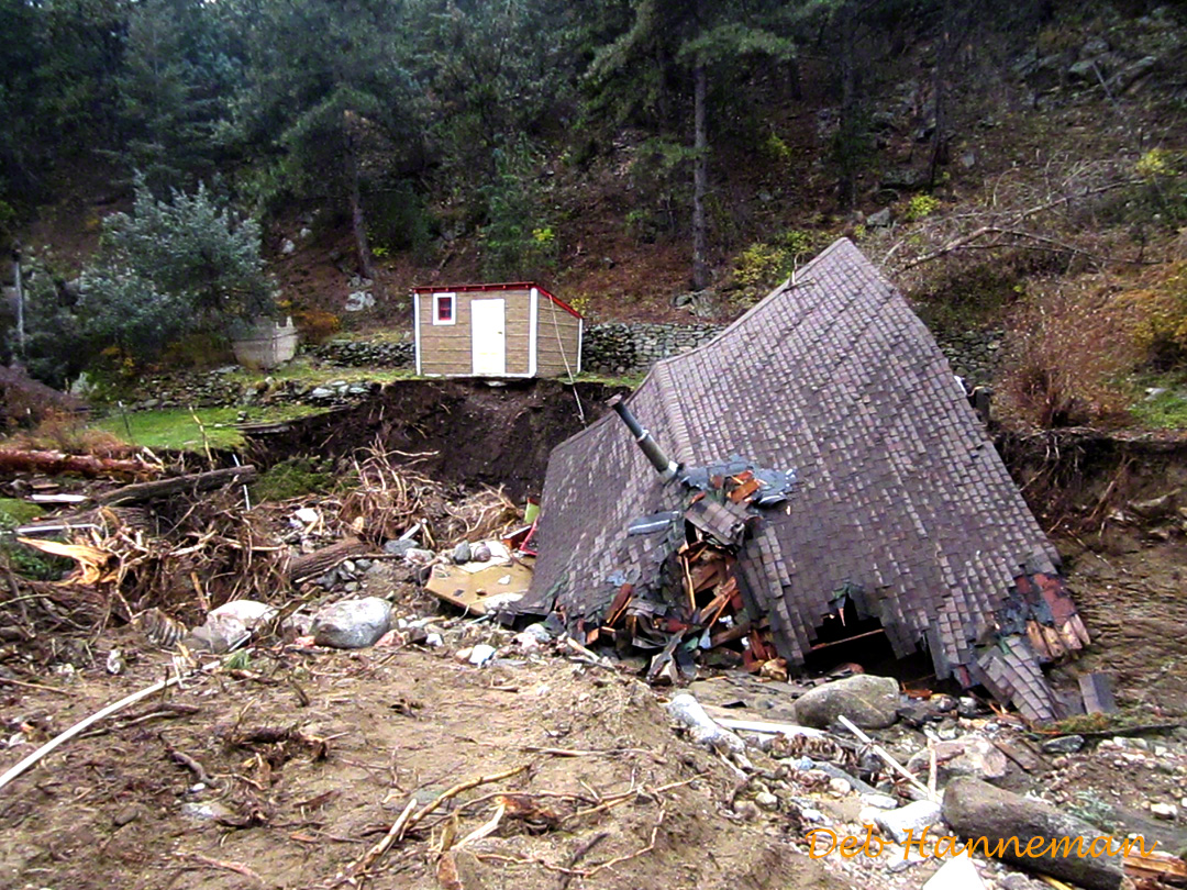
Lastly, the Colorado Front Range storm event of last September is yet another example of geologic hazards generated by record rains that send water cascading through mountainous narrow valleys, producing landslides. I wrote an earlier Geopostings blog on this event and posted photos that I took of some of the flood-damaged areas. The link to my earlier Colorado Front Range storm event blog is: Front Range Storm Event
Update: Dave Petley (The Landslide Blog) has an excellent posting on the Oso landslide – The Oso (Steelhead) landslide: mechanisms of movement and the challenges of recovering victims.
