Self Guided Montana Geology Tours
Geopostings is pleased to provide the service of self-guided geology field trips. The field trip guides are put together by Whitehall Geogroup, Inc., which is to say that the guides are done by two Ph.D. earth scientists, both of whom have several decades experience in field geology. We offer both pre-compiled field trip guides and guides for custom designed field trips. Our pre-compiled field trip guides are presently for areas in southwestern Montana. Custom designed field trip guides can be provided for other areas of geologic interest. The field trip hike guides are presented as Adobe Acrobat pdfs.
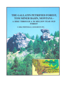
PETRIFIED FOREST GEO-HIKE
The Petrified Forest hike is in that part of the Gallatin Petrified Forest that is located in the Tom Miner Basin (approximately 37 miles south of Livingston, Montana). The field trip winds through a part of the Gallatin National Forest, and is about two miles in length. Access to the trail head is by county road, and can be reached by passenger car. 
The Gallatin Petrified Forest field trip guide is formatted to 12 pages that are standard letter size. The guide includes 11 photographs of geology viewed during the hike, 2 maps (a topographical map with hiking information and a road map), one line diagram, and text detailing the petrified forest deposits. Cost for the field trip guide is $5.00 USD for a pdf file email attachment.
To order the Gallatin Petrified Forest Self-Guided Geology Tour email whgeol@gmail.com for further information on this.
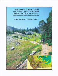
FAIRY LAKE TO SACAGAWEA PEAK (NORTHERN BRIDGER RANGE) GEO-HIKE
There are two hikes contained within this guide for the Fairy Lake area, an area which is located in the northern Bridger Range, approximately 22 miles north of Bozeman, Montana. Both hikes are in the Gallatin National Forest. One hike, from Fairy Lake to Sacagawea Peak is about 4.4 miles in length. The other hike, a loop around Fairy Lake, is about 1.2 miles in length. Access to the trailhead is by a Forest Service road, and can be reached by passenger car after July 1. The hike from Fairy Lake to Sacagawea Peak takes the hiker through a fairly complete section of Paleozoic rocks. The loop around Fairy Lake winds through a part of the Mesozoic section of rocks. 
The Fairy Lake Field Trip Guide is formatted to 15 pages that are standard letter size. The guide includes 19 photographs of geology viewed during the hike, 3 maps (2 topographic maps with hiking information and one road map), a geologic time scale, and text detailing the geology along the hike. Cost for the field trip guide is $5.00 USD for a pdf file email attachment.
MONTANA CADASTRAL DATA
MONTANA CADASTRAL DATA: For those who do hiking cross-country and geologic fieldwork in Montana – AND – need to have landowner permission for access to private property, NRIS now offers a Montana cadastral data base that better facilitates this process – Go to: CADASTRAL DATA.
