A few days ago I did the hike to Grinnell Glacier, one of the iconic glaciers in Glacier National Park. The glacier lies within the Swiftcurrent drainage area, in the northeastern part of the park. The hike, at least the way I did it, is about 11.6 miles round trip. It is possible to catch a boat ride at the Lake Josephine Boat Dock by the Many Glacier Hotel, which cuts the hike down to about 7.5 miles round trip. But – the first boat goes out at about 8.30 am, and as I didn’t want to wait around for it, I decided that adding on the extra miles for a fairly level stretch around Swiftcurrent Lake and Josephine Lake would be easy to do. It is an easy hike around the lakes and a very good warm-up for the rest of the climb to Grinnell Glacier. But – be aware that this area is known for grizzly bear activity as I found out when I met up with a grizzly on the trail. Because I’m writing about this encounter, it obviously ended OK, although I was glad I had bear spray readily available.
The glacier is named after George Bird Grinnell, who first explored this area during the summer of 1885. Because of bad weather, he did not actually get to the glacier during his 1885 travels. However, during the late fall of 1887, he was able to pack most of the way into the glacier by mules, and then hike the remaining distance by foot. Although he certainly was not the first person to see the glacier, the glacier does bear his name, presumably given it by a Lieutenant John H. Beacom of the United States Army, 3rd Infantry, who accompanied him on the 1887 trip to the glacier.
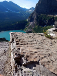
Back to the hike – after about a mile from the junction of the Swiftcurrent Lake Trail with the trail coming from the North Shore of Lake Josephine boat dock, Grinnell Lake comes into view. A little further along the trail one can see Grinnell Falls dropping several hundred feet down from the headwall behind Grinnell Lake.
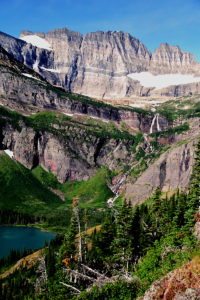
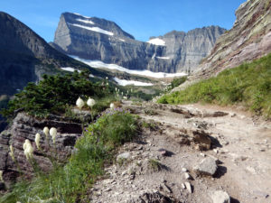
And – even at this distance, Salamander and Gem glaciers pop into view in the distant cirque. The hike continues along beautiful alpine meadows and even through one waterfall that cascades down the cliff adjacent to the trail. There is a rest area with pit toilets right before hiking the final switchbacks that traverse the terminal moraine to the Grinnell Glacier Overlook.
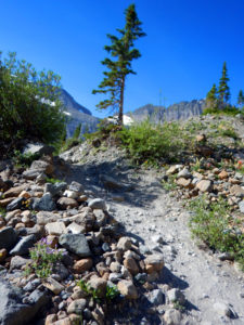
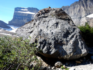
The three glaciers that once comprised the Grinnell Glacier occupy parts of a cirque developed along the area called the Garden Wall.
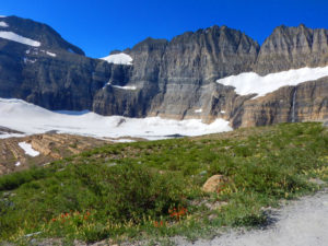
Grinnell Glacier is still the largest of the three ice fields and covers about 152 acres. Unfortunately, this glacier is receding rapidly as the U.S.Geological Survey notes that from 1966 to 2005 it lost about 40% of its acreage. At about 5 acres, the hanging glacier called Gem Glacier, is the smallest named glacier in the park. It sits in the notch on the cliff face above the Grinnell Glacier. This glacier lost about 30 percent of its acreage from 1966 to 2005. The Salamander Glacier covers about 57 acres on a ledge off to the east side of the Grinnell Glacier. It apparently separated from the Grinnell Glacier sometime before 1929 and has undergone a 23% size reduction from 1966 to 2005.
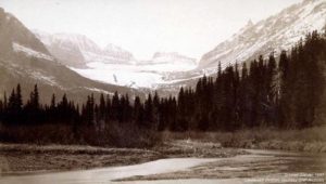
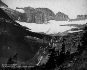
For those interested in viewing photographs of the Grinnell Glacier from various times and viewpoints, the U.S. Geological Survey’s Repeat Photography Project has many archived photographs. This project is a documentation of glacial decline through photography and it is well worth perusing through their photo archives. Two of the earlier photographs are shown below – one from the original 1887 trek and a later view of the glacier from 1940 just to pique one’s interest.
Great article, Debbie! I enjoyed the photos and the links also. The photos are sufficient documentation of climate change and point out the need to remediate the situation, not years from now, but NOW. Thank so much for taking the time to write this.